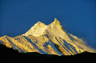
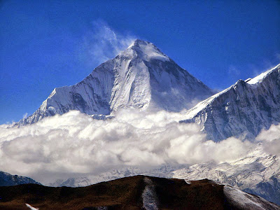
Posts

Showing posts with the label WORLD'S HIGHEST MOUNTAINS

10- ANNAPURNA

Image
Annapurna is a part of the Himalayas in north-central Nepal that includes  26,545 ft  ( 8,091 meters ) Annapurna I, thirteen additional peaks over  22,970 ft  ( 7,000 meters ) and 16 more over  19,690 ft  ( 6,000 meters ). This section is a 55 kilometre-long massif bounded by the Kali Gandaki Gorge on the west, the Marshyangdi River on the north and east, and Pokhara Valley on the south. Annapurna I is 10th among Earth's fourteen eight-thousanders. 8167 metre Dhaulagiri I rises thirty four kilometres to the west across the Kali Gandaki Gorge, which is the Earth's deepest canyon. Annapurna is a Sanskrit word which literally means "full of food" (feminine), but is normally translated as Goddess of the Harvests. In Hinduism, Annapurna is the mother who feeds. Her most popular shrine is located in Kashi, on the banks of the river Ganga." Her association with the giving of food or wealth led her in time to be transformed into Lakshmi, the Goddess of...

9- NANGA PARBAT (Killer Mountain)

Image
Nanga Parbat is the 9th highest mountain in this planet. It is the western anchor of the Himalayas around which the Indus river skirts before it debouches into the plains of Pakistan. Nanga Parbat means naked mountain. It is situated in the Gilgit-Baltistan region of Pakistan. Nanga Parbat is one of the eight-thousanders, with a summit elevation of 26,660 ft (8,126 metres). An immense, dramatic peak rising far above its surrounding terrain, Nanga Parbat is also a notoriously difficult climb. Numerous mountaineering casualties in the mid and early twentieth century lent it the nickname "killer mountain". This mountain has never been climbed in winter.

8- MANASLU

Image
Manaslu (also known as Kutang) is the 8th highest mountain in this planet, and is situated in the Mansiri Himal, part of the Nepalese Himalayas, in the west-central part of Nepal. Manaslu means "Mountain of the Spirit", comes from the Sanskrit word Manasa, meaning "soul" or "intellect". Manaslu was first climbed on 9th May, 1956 by Gyalzen Norbu and Toshio Imanishi, members of a Japanese expedition. It is said that "just as the British consider Mount Everest their mountain, Manaslu mountain has always been a Japanese mountain". Manaslu at 26,759 ft (8,156 metres) above mean sea level is the highest peak in the Lamjung District and is located about 40 miles east of Annapurna. The mountain's long ridges and valley glaciers offer feasible approaches from all directions, and culminate in a peak that towers steeply above its surrounding landscape, and is a dominant feature when viewed from afar. The Nepalese Government only permitted tre...

7- DHAULAGIRI

Image
The mountain's name is धौलागिरी (dhaulāgirī) in Nepali language. This comes from Sanskrit where धवल (dhawala) meaning is dazzling, white, beautiful and गिरि (giri) meaning is mountain. Dhaulagiri I is the highest point of the Gandaki river basin. The Dhaulagiri massif in Nepal extends 120 km from the Kaligandaki River west to the Bheri. This massif is enclosed on the north and south-west by tributaries of the Bheri and on the south-east by Myagdi Khola. Dhaulagiri I at  26,795 ft  (8,167 metres) ranks seventh among world's 14 peaks over 8 thousand metres. It was first climbed on 13th May 1960 by a Swiss/Austrian/Nepali expedition.

6- CHO OYU

Image
Cho Oyu is the 6th highest mountain in the world at 26,906 ft (8,201 metres) above sea level. Cho Oyu means "Turquoise Goddess" in Tibetan. The mountain is the westernmost major peak of the Khumbu sub-section of the Mahalangur Himalaya 20 kilometres west of Mount Everest. This mountain is located at the Tibet-Nepal border. Just a few kilometres west of Cho Oyu is Nangpa La (18,753 ft), a glaciated pass that serves as the main trading route between the Tibetans and the Khumbu's Sherpas. This pass separates the Khumbu and Rolwaling Himalayas. Due to its proximity to this pass and the generally moderate slopes of the standard northwest ridge route, Cho Oyu is considered the easiest 8,000 metre peak to climb.

5- MAKALU

Image
Makalu is the 5th highest mountain in the world at 27,825 ft (8,481 metres) and is located 19 km southeast of Mount Everest, on the border between Nepal and China. Makalu is an isolated peak whose shape is a four-sided pyramid. Makalu has two notable subsidiary peaks. Kangchungtse, or Makalu II (7,678 meters) lies about 3 km north-northwest of the main summit. Rising about 5 km north-northeast of the main summit across a broad plateau, and connected to Kangchungtse by a narrow, 7,200 meters saddle, is Chomo Lonzo. Makalu was first climbed on 15th May 1955 by Lionel Terray and Jean Couzy of a French expedition led by Jean Franco. Franco, G. Magnone and Sardar Gyaltsen, Norbu summitted the next day, followed by Bouvier, S. Coupe, Leroux and A. Vialatte on the 17th May 1955.

4- LHOTSE

Image
Lhotse is the 4th highest mountain in the World and is connected to Everest via the South Col. Lhotse means “South Peak” in Tibetan. In addition to the main summit at 27,940 ft (8,516 metres) above sea level, Lhotse Middle (East) is 27,605 ft (8,414 meters) and Lhotse Shar is 27,503 ft (8,383 meters). It is located at the border between Tibet (China) and the Khumbu region of Nepal. Lhotse's south face rises 3.2 km in only 2.25 km of horizontal distance, making it the steepest face of this size in the world. The south face has been the scene of many failed attempts, some notable fatalities, and very few ascents.

3- KANGCHENJUNGA

Image
Kangchenjunga is the third highest mountain in the world, with an elevation of 28,169 ft (8,586 meters) in a section of the Himalayas called Kangchenjunga Himal that is limited in the west by the Tamur River and in the east by the Teesta River. Kangchenjunga is located on the boundary between Nepal and the Indian state of Sikkim. It is the highest peak in India and the easternmost of the peaks higher than 26,000 ft (8,000 meters). It is called Five Treasures of Snow after its five high peaks. This mountain has always been worshiped by the people of Darjeeling and Sikkim. Until 1852, Kangchenjunga was considered to be the highest mountain in the world, but calculations based on various readings and measurements made by the Great Trigonometric Survey of India in 1849 came to the conclusion that Mount Everest was the highest mountain. It was officially announced in 1856 that Kangchenjunga is the third-highest mountain. Kangchenjunga was first climbed on 25 May 1955 by Joe Brow...

2- K2

Image
K2 is also known as Chhogori/Qogir, Ketu/Kechu, and Mount Godwin-Austen. It is the second-highest mountain on Earth, after Mount Everest. It is located on the border between Baltistan, in the Gilgit–Baltistan region of northern Pakistan, and the Taxkorgan Tajik Autonomous County of Xinjiang, China. It has a peak elevation of 28,251 feet (8,611 meter). K2 is the highest point of the Karakoram Range and the highest point in Pakistan. K2 is known as the Savage Mountain due to the extreme difficulty of ascent and the second-highest fatality rate among the eight thousanders. For every four people who have reached the summit, one has died trying. It is more hazardous to reach K2 from the Chinese side; thus, it is mostly climbed from the Pakistani side. Unlike Annapurna, the mountain with the highest fatality-to-summit rate, K2 has never been climbed in winter.

1- MOUNT EVEREST

Image
Mount Everest it the Earth's highest mountain, with a peak at 29,029 ft (8,848 meters) above sea level and the fifth tallest mountain measured from the centre of the Earth. Its location is in the Mahalangur section of the Himalayas. Mount Everest attracts many highly experienced mountaineers as well as capable climbers willing to hire professional guides. There are two main climbing routes, one approaching the summit from the southeast in Nepal (known as the standard route) and the other from the north in Tibet.    While not posing substantial technical climbing challenges on the standard route, Everest presents dangers such as altitude sickness, weather, wind as well as significant objective hazards from avalanches and the Khumbu Icefall. While the overwhelming majority of climbers will use bottled oxygen in order to reach the top, some climbers have summitted Everest without supplemental oxygen.